This is achieved through continuous support to undertake Wetland Assessments in the region. Through this a number of technical officers from the member states have gained hands on training from the Wetlands Monitoring with Earth Observation Data Project (GlobWetland Africa project).
The Wetlands Monitoring with Earth Observation Data project which has been implemented in the Republic of Uganda with the Ramsar Centre for Eastern Africa (RAMCEA) as the lead implementing organisation. Other organisations included Ministry of Water and Environment of the Republic of Uganda, DHI GRAS, Denmark, GeoVille, Austria, ITC University of Twente, Netherlands, European Space Agency, Italy, Uganda Bureau of Statistics, Uganda and Makerere University, Uganda.
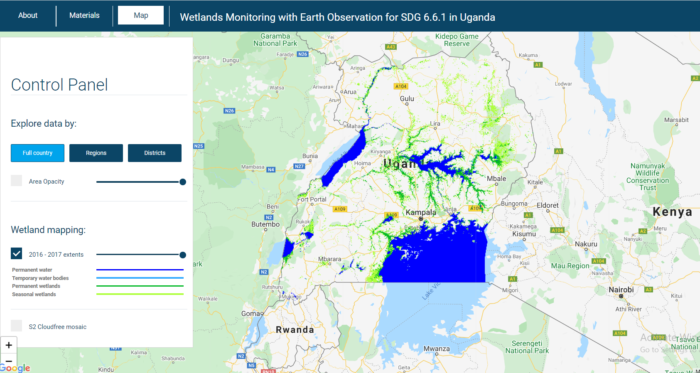
This project developed, implemented and trained a user friendly monitoring system providing national authorities with operational capacity to generate spatial time series statistical data for inventorying, monitoring and quantitatively reporting on national wetland resources using Earth Observation data.
The project was consistent with the upcoming monitoring requirements in the context of SDG indicator 6.6.1 “Change in the extent of water-related ecosystems over time”. It also recognized the critical importance of supporting developing countries in strengthening the capacity of national statistical offices and data systems to ensure access to high quality, timely, reliable and disaggregated data.
The Earth Observation Support on monitoring and reporting on wetlands project has been implemented in a period of 1 year from 2017 to 2018 with a total project cost of 250,000 USD from the Global Partnership for Sustainable Development Data.